The River Avon
Pulteney Weir to Bathampton
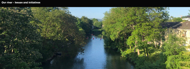
The Bathwick Estate borders the River Avon for approximately half a mile. There is no public access along this stretch, but around 70 homes have gardens with direct access (34 flats - Horton House and Forester Court and around 35 houses on Rockliffe Road, Rockliffe Avenue and Hampton Row). The Boating Station and Cleveland Pools also sit alongside the river.
Issues: Riverbank erosion, river pollution, river users safety, flooding
Riverbank erosion cause:
River traffic at summertime water level, plus winter flooding.
Effect:
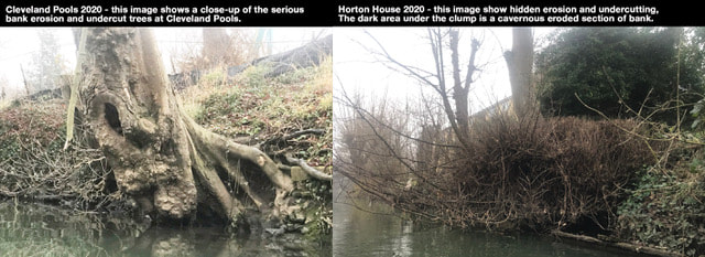
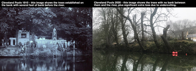
Loss of trees, loss of land/banks. This is caused by serious undercutting of trees along the bank and subsequent erosion after the tree has fallen into the river and been swept away (Note: those trees that we see every year on Pulteney Weir have come from a riverbank somewhere upstream. Note: Approx. 80% of trees on the banks in Bathwick are at risk).
Risks:
Loss of land. Compromised supporting walls and buildings. Loss of biodiversity. Long-term flood risk.
This is not a new issue:
This stretch of river has been a subject of concern for over 30 years, with efforts made in 1985, 2000 and now 2022 to preserve and maintain this important stretch of river, this is a well-documented issue. In around 2000/2001 the environment agency did carry out an assessment and noted that the erosion was happening in the summer (summer water level) and therefore erected speed limit signs of 4mph. This however has never been policed and therefore is often ignored.
Who is using the river?
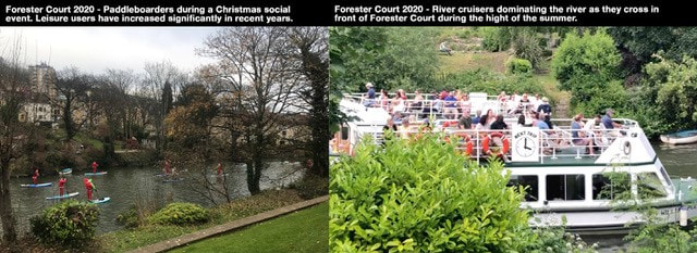
Commercial use is increasing, in the past year there have been barges delivering to Cleveland Pools, tour boats operating from March till November, safety boats operating at Cleveland Bridge, and when Cleveland Pools are open there is a proposed river taxi.
Loss of habitat and an unhealthy river
Severe erosion is causing properties at the town end of this stretch to build protective walls, which often result in the loss of natural habitats due to the loss of plant life on the bank. As erosion continues, more properties will look to protect their banks leading to a much more industrialised river with significant loss to nature. This combined with pollution is putting this important stretch of river and its rich nature at risk.
Pollution Cause: Engine diesel, forever chemicals from farmland, sewage overflow.
Effect: Risk to health of wildlife as well as the increasing numbers of leisure users - swimmers, paddleboarders, canoeists etc.
Safety of leisure users (non-powered)
The number of leisure users is rising rapidly,swimmers, paddleboarders, canoeists etc. And with the new ownership of Bathwick Meadows by the National Trust, this is set to increase dramatically. Up until now, access to this stretch has been very limited.
Increased commercial traffic often not adhering to the 4MPH limit, private and unregulated motored craft, and pollution, all pose a risk to safety and enjoyment of this stretch.
Flooding:
Whilst it will take a ‘one in a hundred years’ event to flood the houses and flats on the riverbank this should not be ignored, especially as the river erosion means that the water is getting nearer to the properties every year. Climate change is a clear risk to this happening and would affect more than just the immediate houses. Several river escape routes (lower sections) and water coming up from below ground mean many other areas could be affected.
What BERA is doing about these issues?
1. We are in ongoing discussions with the council and have had on-site meetings with councillor Jess David and Mark Minkley (Environmental Manager).
Note: Long-term improvements could come through the Bath Riverline project and the WaterSpace project.
2. We are in discussion with Cleveland Pools about sustainable options for their river taxi. Ideally this should be electric to prevent the pollution issues of diesel, and smaller than the current tour boats. The speed limit should always be adhered to.
3. We are engaging and raising these issues with other stakeholders on this stretch of river.
4. We are looking to link-up with BART https://bristolavonriverstrust.org to monitor river pollution and for general support and advice.


